


BLOCK
Description:
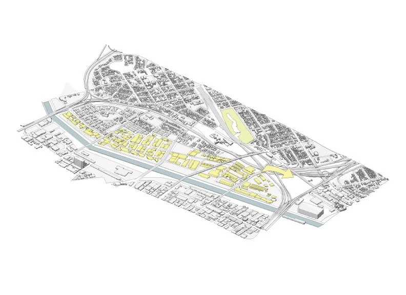
Los Angeles is a composition of many different urban grids. Each grid is correlated to years of different social and ecological developments. The main focus of the project is concentrated on the site which is bordering Downtown Los Angeles and East Los Angeles. This node is located at the freeway intersection of the 5 freeway, 10 freeway, and the 60 freeway. This is a binary context consisting of the low density residential grid of East LA vs the dense industrial grid of Downtown LA's warehouse district.
Objective:
A landuse objective. The downtown Industrial warehouse district is a depleting region with many empty vacated facilities. The square footage borders the Los Angeles River adjacent to the East LA Neighborhood. These neighborhoods were truncated by industrial growth 60 years ago in Los Angeles. These Neighborhoods were carved by the growing and expanding city highways. The objective of the the project is to swap the Industrial Land use zoning in East Los Angeles for open land agriculture. The square footage of the Industrial warehouses will be combined into a mega structure in the node adjacent to both cities. This object is composed of variations of land use density vertically. Each level is composed of different girds.